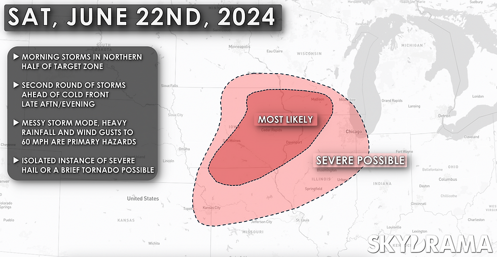
As Saturday, June 22 has drawn closer, I've lost a little interest in the setup from a storm observation perspective. There still looks to be a favorable zone for scattered severe thunderstorms that more than anything are likely to exacerbate an ongoing flooding situation across the region. Portions of southern Minnesota and northern Iowa have dealt with multiple rounds of heavy rain in recent days and another 24 hours of storms through Saturday night will only make things worse.
Most of the details for Saturday remain on track - a morning MCS will track through portions of southern Minnesota and northern Iowa during the pre-dawn and early morning hours, shifting into southern Wisconsin and northern Illinois through mid-day.
A cold front extending south from an area of low pressure in Minnesota will force renewed thunderstorm development across far southern Minnesota into northern and central Iowa mid-afternoon on Saturday.
What's keeping this from being a more interesting chase day?
With a cold front that has become increasingly oriented southwest to northeast, the frontal boundary is essentially parallel to the wind shear vector. This sort of alignment fosters linear storm modes and upscale growth. Additionally, the lack of an EML or dry slot with this system makes me think the warm sector will be fairly dirty with lots of cloud cover and grunge, with messy storms that have a hard time really taking off.
So, while I expect storms to be fairly widespread, I think the severity of this event will be limited. Numerous severe storms are possible, but they'll probably produce a smattering of 60 mph wind gusts and locally torrential rainfall that'll exacerbate flooding that's ongoing in some areas. An isolated instance of severe hail and a tornado is possible should a supercell or two develop initially - not impossible, but not terribly likely.
For those reasons I'll probably sit the day out and hang back in central Illinois, perhaps entertaining the idea of meandering out for an incoming MCS later Saturday evening into Saturday night. Still, I'll keep an eye on trends through the next 24 hours and reserve the right to head out if I feel compelled to do so! There are a lot of things that are more exciting than sitting at home and hiding in the air conditioning all day, but I'm not yet sure that driving to eastern Iowa for a shelf cloud is one of those things.
